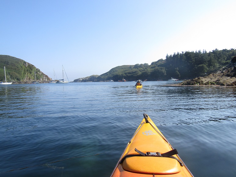
It seems as if the summer is passing us by. Plenty of sunshine, so much to do in the garden, books to write, studying to undertake… But there comes a day when we down tools and heave the kayaks onto the Land Rover.

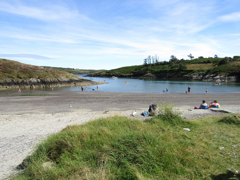
Tralispean beach is located loosely between Baltimore and Castletownshend, along a patch of largely isolated coastline. The wiggly bits were probably designed by Slartibartfast, if you know your Hitch Hiker’s Guide to the Galaxy. This tiny beach is an easy place to get the boats into the water. As it has no tourist facilities, although there are quite a few local families enjoying the sun, it retains a peaceful sense of isolation.
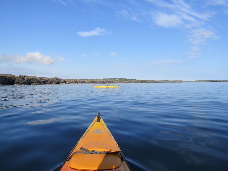
The Atlantic usually looks grey and forbidding, but today we head out of the bay into amazingly blue waters. Being in kayaks, though, we’re DEFINITELY hugging the coast. The water is surprisingly millpond-ish, but can change in an hour if the wind picks up. If we keep heading out, the next stop would be the Fastnet Rock.
Do you recall the Fastnet race of 1979, in which 19 people died? 303 yachts started out, but a freak storm arose. Many boats and lives were lost during what turned into the biggest maritime rescue operation since the war. But today, the Atlantic is smiling; butter wouldn’t melt in her mouth.
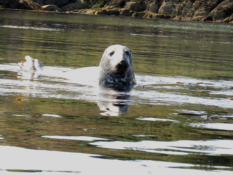
On the way out of the bay we see several seals. This one is basking on his back, until we draw too close. He rolls over, tells us off in a guttural bark, for invading his space, and slips away under the water.
We paddle north around the coast, and hit Barloge creek, a small, deep inlet where yachties like to moor. The creek leads into Lough Hyne. The Lough was once an inland freshwater lake created by the passage of melt water in the ice-age. Rising sea levels encroached, making it a coastal lake. Around four centuries ago, it was infiltrated by saline water, creating a unique marine environment: sea life, but protected from the worse of the Atlantic weather. It’s now a Marine Nature Reserve.
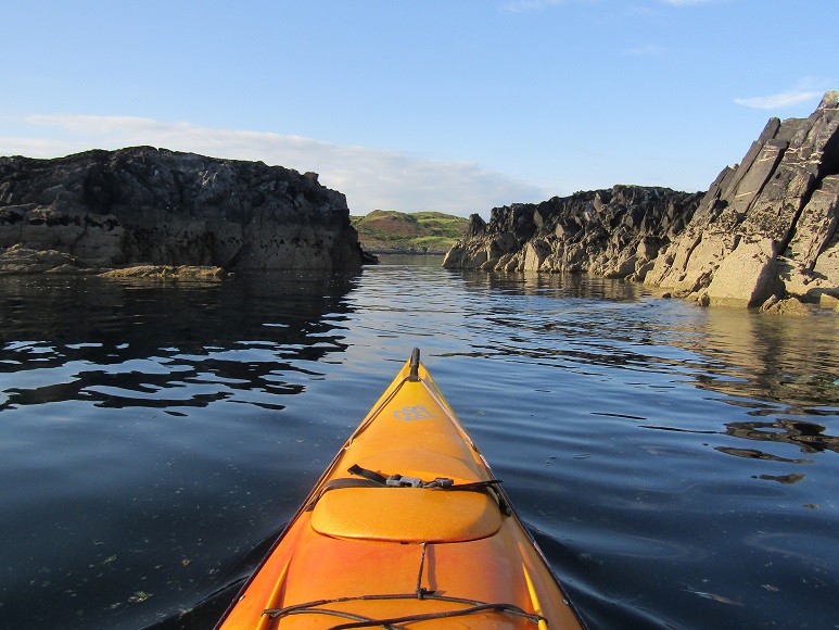
One of the reasons for us making this trip is to check out the sea caves, and the exposed geology.
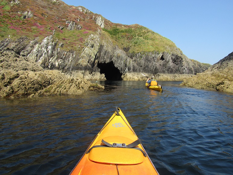
The caves have all the visual potential for a disaster movie, those jagged rocks about to slip down on us….
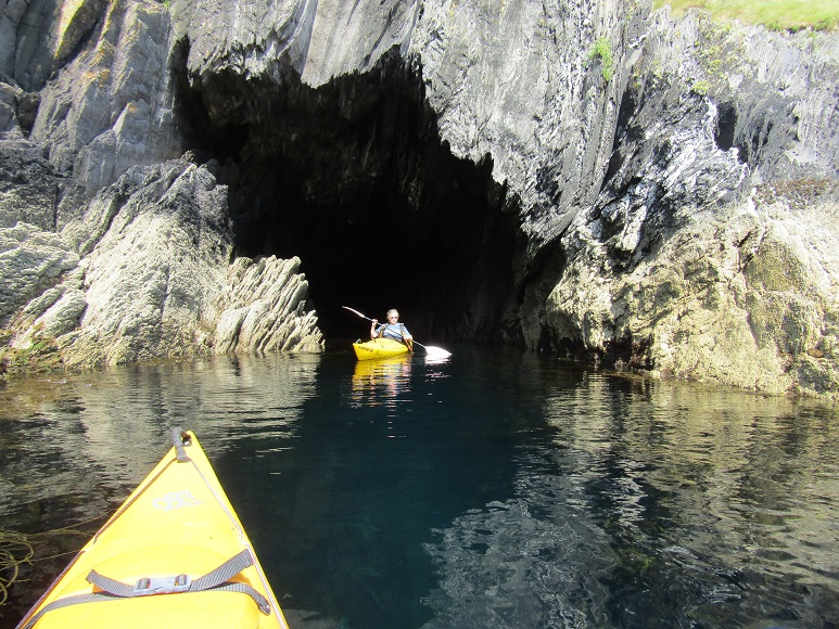
Caving was my passion for many years, and in truth this is a fairly safe adventure compared to some of the flood passages I once scrambled through. The water is lagoon blue-green, and clear. Note the rock on the left? It’s not a trick of the sunlight. It’s a huge boulder of quartz. The sea is so clear it takes a moment to work out what is rock and what is reflection.

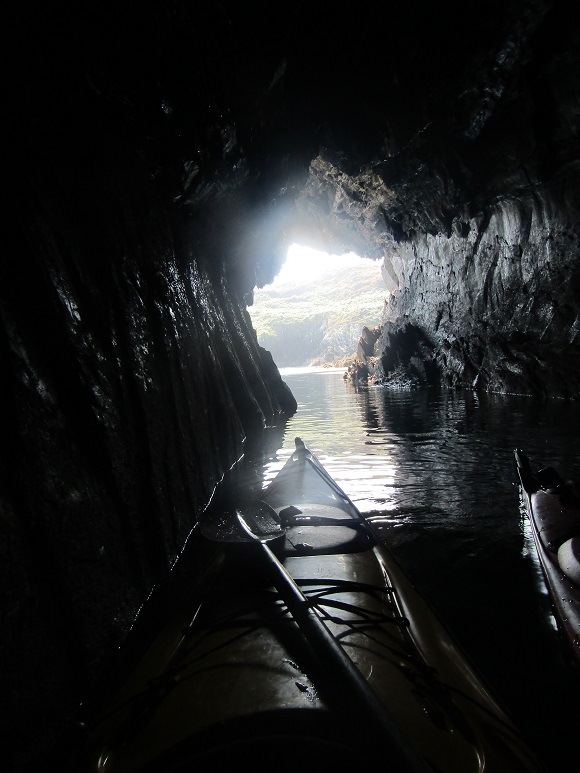
And the view from inside…
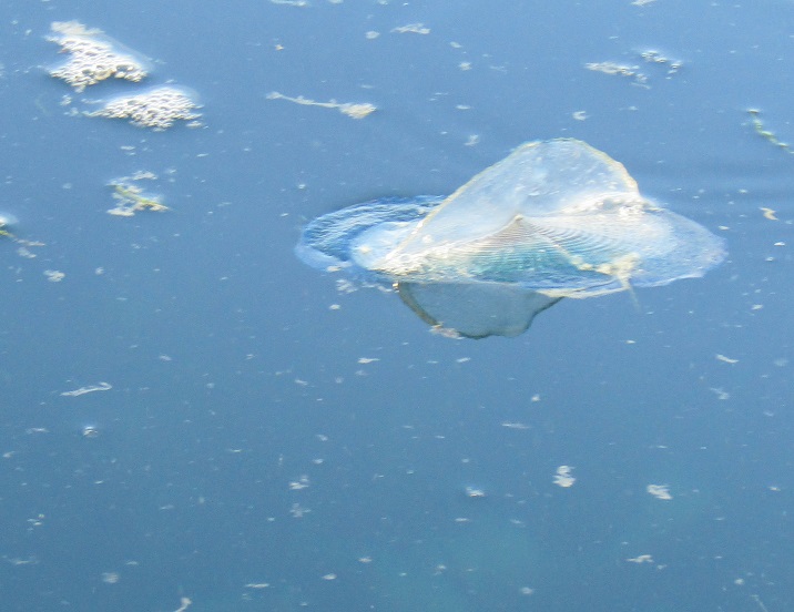
One of the amazing things is the number and variety of jellyfish. I wasn’t sure our little point-and-click camera would record them, but far from the days of the Kodak Brownie, the camera performed beyond expectations, not just photographing the shiny surface, but what lies beneath. I don’t know much about jellyfish, except that they can be incredibly beautiful, and one avoids touching the trailing fronds!
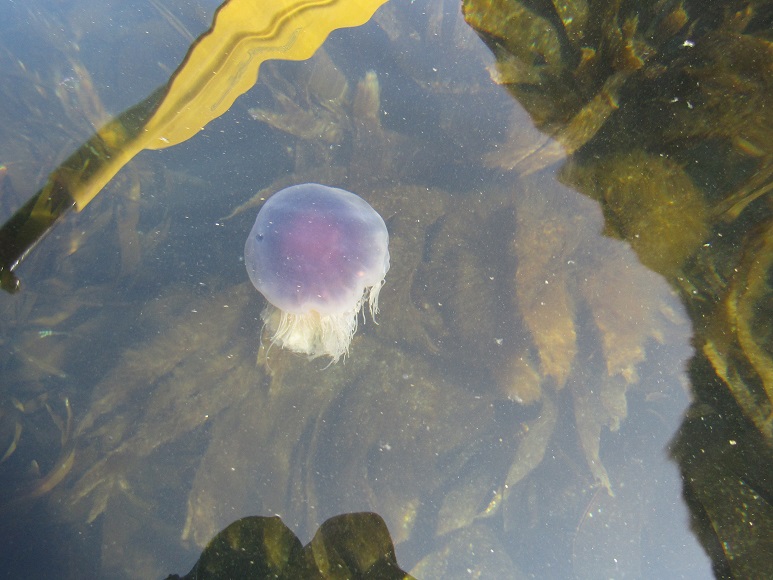

This guy is probably a Compass Jellyfish.

This strange little fellow is called Velella, or, By-The-Wind-Sailor.
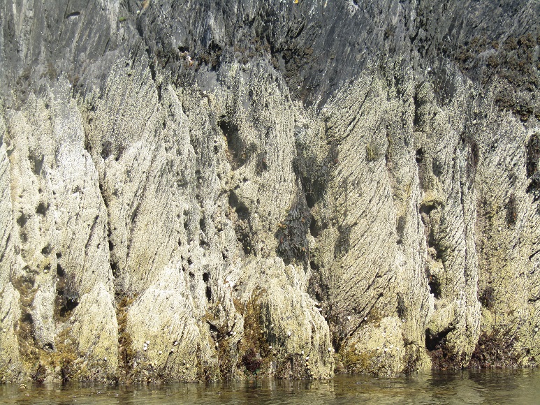
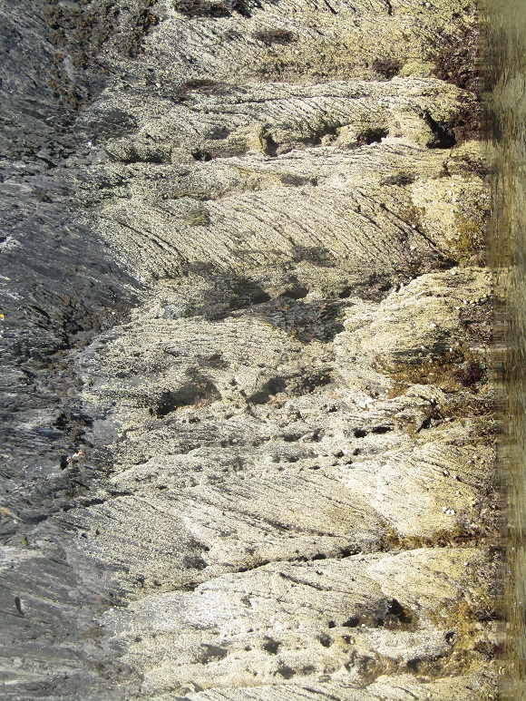
Now we come to the geology. The steep sides of the inlet are made up of the Sherkin Formation, which is a grey and green sandstone and mud. This rock was formed around 380 million years ago, in the late Devonion period, in what is now termed the Munster Basin. Back then, the surrounding environment was arid desert, located just south of the equator. The strange formations were made by layers of silt and mud and sand washing in and overlapping at slightly different angles, then being put under great pressure to form rock. The Munster basin eventually became the deepest sedimentary basin in Europe. The sediment would eventually reach over four miles thick. Tectonic plate movement then shifted the whole mass by nearly 90 degrees to what you see today.
Below, I’ve shifted the image 90 degrees, making it easier to envisage the layering of sediments which created these formations.
The narrow passage leading into Lough Hyne, in the centre of the image, below, isn’t navigable. At present the water is flowing out with the tide, and when the tide comes in, the water will start to flow through this constriction the other way, but such is the volume of water in the lough, it never catches up with the change in sea level. The smaller tidal range inside the lough provides for a truly stable saltwater environment, a haven for sea urchins and anemones and other creatures. This little patch of ‘rapids’ is a fun place for ‘white-water’ kayaks, with their egg-shaped design and smooth hulls. Our sea kayaks are about 15 feet long, around twice the length of a white water kayak, and have small rudders and the hint of a keel. They’re designed for speed and distance, not manoevrability. The longer the canoe, the faster it ploughs through the water.

Finally, we paddle back towards the entrance of Barloge Creek, to go around the coast back to Tralispean. It’s early evening when we arrive. So we take time out to sit in the Land Rover and enjoy a quiet bottle of beer, as we watch the day fade.
